|
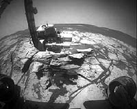
Pasadena CA (JPL) Nov 30, 2007 Opportunity spent much of the week conducting ongoing studies of a layer of rock known as "Smith," part of a "bathtub ring" of rocks that circumvent "Victoria Crater" beneath the rim. Opportunity acquired images and studied the composition and abundance of iron-bearing minerals in the rock. During tests of the rock abrasion tool on the Earthbound engineering rover similar to the rover on Mars, engineers discovered that unbending the brush on Opportunity's rock abrasion tool may not be possible. Instead of brushing the surface of a new rock target known as "Smith2," rover handlers opted to proceed directly to grinding the rock surface during the coming weekend, on sol 1368 (Nov. 29, 2007). On Sol 1359 (Nov. 20, 2007), a joint in Opportunity's robotic arm (Joint 1) that controls azimuth (left-right motion) stalled during the acquisition of microscopic images of the unground surface of Smith2. Plans called for the rover to acquire the rest of the microscopic images on sol 1366 (Nov. 27, 2007). After the stall, the rover acquired information about the atmosphere rather than the rock target with the alpha-particle X-ray spectrometer. Sol-by-sol summary: In addition to morning uplinks directly from Earth via the rover's high-gain antenna, evening downlinks to Earth via the Odyssey orbiter at UHF frequencies, and standard panoramic-camera measurements of atmospheric opacity caused by dust, Opportunity completed the following activities: Sol 1355 (Nov. 16, 2007): Opportunity placed the Mossbauer spectrometer back on the rock target known as "Smith" and acquired data for 11 hours with the instrument. Opportunity used the navigation camera to determine the rover's attitude by looking at the sun, searched the sky for clouds with the navigation camera, and surveyed the horizon with the panoramic camera. Sol 1356: Opportunity spent 12 hours collecting data from Smith with the Mossbauer spectrometer and acquired super-resolution images of "Cape Verde," a promontory on the rim of Victoria Crater. The rover used the navigation camera to search the sky for clouds and estimate the rover's attitude relative to the sun. Opportunity acquired super-resolution images of "Cabo Frio," another promontory on the rim of Victoria Crater, and took spot images of the sky with the panoramic camera. Sol 1357: Opportunity spent 12 hours collecting data from Smith with the Mossbauer spectrometer and used the navigation camera to search the sky for clouds and measure the rover's attitude by looking at the sun. The rover took more super-resolution images of Cabo Frio and thumbnail images of the sky with the panoramic camera. Sol 1358: Opportunity spent 12 hours collecting data from Smith with the Mossbauer spectrometer and used the navigation camera to search the sky for clouds and measure the rover's attitude by looking at the sun. The rover acquired super-resolution images of Cape Verde and surveyed the horizon with the panoramic camera. Opportunity scanned the sky for clouds with the navigation camera. Sol 1359: Opportunity switched to a different target of study, a nearby clean spot of rock surface nicknamed Smith2. While the rover was acquiring image mosaics of the rock target with the microscopic imager, the shoulder joint of the robotic arm stalled. The rover acquired 12 hours worth of compositional data from the Martian atmosphere with the alpha-particle X-ray spectrometer. The next morning, the rover calibrated the panoramic camera by taking images in darkness, scanned the sky for clouds using the navigation camera, monitored dust on the rover mast, and took spot images of the sky with the panoramic camera. Sol 1360 (Nov. 21, 2007): Opportunity acquired a mosaic of images of a target called "Paolo's Pan" with the panoramic camera and calibrated the panoramic camera by taking images in darkness. The rover scanned the sky for clouds with the navigation camera. The next morning, Opportunity was slated to use the navigation camera to estimate the rover's attitude by looking at the sun. Odometry: As of sol 1359 (Nov. 20, 2007), Opportunity's total odometry remained at 11,584.32 meters (7.2 miles). Related Links Opportunity Mars News and Information at MarsDaily.com Lunar Dreams and more
 Pasadena CA (SPX) Nov 29, 2007
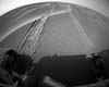
On the way to "Winter Haven 3," the spot on the north face of "Home Plate" where NASA's Spirit rover is headed, the rover has driven into an area below a hummock (elevated area). Spirit has tried unsuccessfully during the past week to climb onto the hummock and make progress toward Winter Haven 3. Because it is critical to reach the north face while enough solar energy is available to get there, Spirit spends every available day driving. In-between drives, Spirit recharges the batteries and conducts very light remote sensing. |
|
| The content herein, unless otherwise known to be public domain, are Copyright Space.TV Corporation. AFP and UPI Wire Stories are copyright Agence France-Presse and United Press International. ESA Portal Reports are copyright European Space Agency. All NASA sourced material is public domain. Additional copyrights may apply in whole or part to other bona fide parties. Advertising does not imply endorsement, agreement or approval of any opinions, statements or information provided by Space.TV Corp on any Web page published or hosted by Space.TV Corp. Privacy Statement |