 |
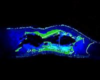
Reston VA (SPX) Aug 19, 2010 New satellite imagery has given scientists the most comprehensive and exact data on the distribution and decline of mangrove forests from across the world. The research, carried out by scientists from the U.S Geological Survey and NASA, is published in Global Ecology and Biogeography, and reveals forest distribution is 12.3% smaller than earlier estimates. Mangrove forests are among the most productive and biologically important ecosystems of the world, including trees, palms and shrubs which grow at tropical and subtropical tidal zones across the equator. Now scientists can use the world's most definitive map of the Earth's mangrove forest to reveal that approximately 53,190 square miles (137, 760 km2) of mangroves exist, substantially less than previous estimates. "Our assessment shows, for the first time, the exact extent and distribution of mangrove forests of the world at 30 meters spatial resolution, the highest resolution ever," said Dr Chandra Giri from USGS. "This reveals that 75% of the remaining forest is found in just 15 countries, out of which only ~6.9% is protected under the existing protected areas network." Mangrove forests have adapted to the most severe environmental conditions thriving in regions of high salinity, scorching temperatures and extreme tides across the equator. However, increasingly human activity and frequent severe storms have taken their toll, resulting in a loss rate for mangrove forests higher than the loss of inland tropical forests and coral reefs. "The current estimate of mangrove forests of the world is less than half what it once was, and much of that is in a degraded condition," said Giri. "It is believed that 35% of mangrove forests were lost from 1980 to 2000 which has had an impact on the coastal communities that use mangrove forests as a protective barrier from natural disasters such as hurricanes and tsunamis." Using data from the NASA satellite Giri and an international team, including 30 student interns and visiting scientists from across the world, analysed more than 1,000 'Landsat' scenes using digital image classification techniques. This enormous task allowed the team to slowly piece together the world's most accurate map of mangrove distribution. This work represents the most comprehensive global database of mangrove forests ever created and has revealed that the world's remaining mangrove forests are spread across 118 countries and territories. Asia has 42% of the world's mangroves, followed by 21% in Africa, 15% in North and Central America, 12% in Oceania and 11% in South America. "The mapping of mangrove forests at this resolution, on a global scale, has never been attempted, partly due to cost and computation limitations," concluded Dr Garik Gutman, from the NASA Land Cover/Land-Use Change Program which funded the project. "The Global Land Survey data produced by NASA and USGS has enabled worldwide land cover projects like this, because pre-processing global coverage of Landsat data at project levels is a gigantic task."
Share This Article With Planet Earth
Related Links U.S Geological Survey Earth Observation News - Suppiliers, Technology and Application
 An Ocean Of Research Via Satellite
Washington DC (SPX) Aug 19, 2010 With the Central Pacific well within reach, SES WORLD SKIES has announced that The Nature Conservancy has secured capacity on its NSS-9 satellite to link researchers studying the Palmyra reef islands with the outside world. Located 1,000 miles south of Hawaii, remote Palmyra Atoll is a National Wildlife Refuge and part of the recently-designated Pacific Remote Islands Marine National Monum ... read more |
|
| The content herein, unless otherwise known to be public domain, are Copyright 1995-2010 - SpaceDaily. AFP and UPI Wire Stories are copyright Agence France-Presse and United Press International. ESA Portal Reports are copyright European Space Agency. All NASA sourced material is public domain. Additional copyrights may apply in whole or part to other bona fide parties. Advertising does not imply endorsement,agreement or approval of any opinions, statements or information provided by SpaceDaily on any Web page published or hosted by SpaceDaily. Privacy Statement |


 del.icio.us
 Digg
Digg Reddit
 YahooMyWeb
 Google