|
Colorado CO (SPX) Apr 27, 2007 The CloudSat Data Processing Center (DPC) has released a Beta version of the final 3 Standard Data Products (2B-CWC-RO, 2B-TAU, 2B-FLXHR). These data are now available to the general science community. It is important for all users to note that these three products, as well as all of the CloudSat Standard Products in release 03 (identified in the filename as "_R03_" ) are provisional products that are still undergoing validation by the CloudSat Science Team. These products will be superseded by Release 04 on/about July 2007 and will, at that time, address known issues and other findings from the results of ongoing validation efforts during the remainder of our first year of data collection. In particular, the CWC, TAU, and FLXHR products are only released at this time for the period of 15 Oct-15 Nov 2006 to allow the science community to become familiar with them and to do their own quantitative assessment of these initial CloudSat products. All data users are asked to review the known issues page of the Data Processing Center website and become familiar with these issues before using the results in publications or presentations. In addition, please report any additional anomalies or questions to the DPC via email or the contact page.
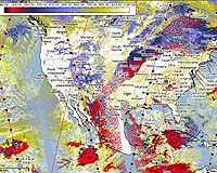
New and Improved CloudSat Tools Online Several online tools for visualizing CloudSat data and ground tracks have been developed or improved in recent months. Chris Galli and Jay Mace of the University of Utah have developed the CloudSat/MODIS Joint Atmosphere Map Browser (listed in the Quick Links as "Google Maps CloudSat Browser"), which overlays CloudSat ground tracks over various MODIS cloud fields on a Google Maps map. Pop-up plots showing CloudSat profiles along the ground-track are obtained by moving the cursor along the plotted ground track. An earlier version of the tool, the CloudSat Beta Profile Browser (also in the Quick Links), shows similar combinations of CloudSat and MODIS data, but at a different scale with better coverage of high latitudes. Phil Partain of the CloudSat DPC has developed experimental orbit track files designed for use with Google Earth; these are available at the DPC Google Earth Resources page, which is included in the Quick Links. Tracks files are available at both 2-minute and 5-second resolutions, together with other files showing the CloudSat calibration region boxes and the tracking stations that downlink CloudSat data. The QuickLook page at the DPC (in the Quick Links) has received a number of updates to make it more informative and easier to use. Information has been added to each granule listing that indicates if there are missing profiles, if the transmitter was not operating, or if a calibration maneuver was performed. These conditions are flagged with a colored box. Clicking on the box will pop-up a window with more details. The page navigation pull-down menu now includes the granule number and date/time for the first granule on each page, making it much easier to jump directly to a page containing a granule you might be interested in. Finally, the quicklook page has been optimized so it should load much faster than it did in the past. Related Links More on this story with detailed links and information Making money out of watching earth from space today Earth Observation News - Suppiliers, Technology and Application
 Vandenberg AFB CA (SPX) Apr 27, 2007
NASA's Aeronomy of Ice in the Mesosphere (AIM) spacecraft, the first mission dedicated to the exploration of mysterious ice clouds that dot the edge of space in Earth's polar regions, successfully launched from Vandenberg Air Force Base, Calif., at 1:26 p.m. PDT on Wednesday, April 25. |
|
| The content herein, unless otherwise known to be public domain, are Copyright Space.TV Corporation. AFP and UPI Wire Stories are copyright Agence France-Presse and United Press International. ESA Portal Reports are copyright European Space Agency. All NASA sourced material is public domain. Additional copyrights may apply in whole or part to other bona fide parties. Advertising does not imply endorsement, agreement or approval of any opinions, statements or information provided by Space.TV Corp on any Web page published or hosted by Space.TV Corp. Privacy Statement |