|
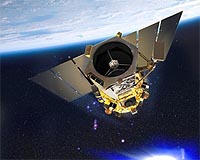
Dulles VA (SPX) Feb 23, 2009 GeoEye has announced that the National Geospatial-Intelligence Agency (NGA) notified the Company that imagery from the GeoEye-1 satellite has been certified as meeting their stringent requirements for quality, accuracy and resolution. GeoEye is now delivering GeoEye-1 sub-half-meter ground resolution satellite imagery to the National Geospatial-Intelligence Agency (NGA). As a result of the certification, the GeoEye-1 satellite is fully commissioned and GeoEye is able to begin recognizing revenue of $12.5 million per month under the terms of a Service Level Agreement (SLA) signed with the NGA in Dec. 2008. Deliveries to NGA begin Feb. 23, 2009. "It gives me great pride to announce we have met the National Geospatial-Intelligence Agency's requirements and are now delivering GeoEye-1 imagery to serve the Agency's comprehensive geospatial intelligence needs," said Matthew O'Connell, GeoEye's chief executive officer. "The NGA continues to be our mission partner, and we appreciate their support during satellite check-out and calibration." "The commercial remote sensing industry can meet a large majority of our national requirements for global mapping and observation, said Bill Schuster, GeoEye's chief operating officer. "Now that GeoEye-1 is fully commissioned, we can assure our customers in the U.S. and overseas they will have access to a continuous supply of high-quality imagery well into the next decade." He said, "We are already working on the advanced camera and camera electronics for GeoEye-2 and look forward to continuing to serve NGA with next-generation capabilities." The NextView program is designed to ensure that the NGA has access to commercial imagery in support of its mission to provide timely, relevant and accurate geospatial intelligence in support of national security. GeoEye won its $500-million NextView contract in September 2004 and was able to build and launch GeoEye-1 within four years of contract award, with no cost overruns. The prime contractor for GeoEye-1 is General Dynamics Advanced Information Systems. The satellite's imaging system was built by ITT Corporation. "With this milestone, we have delivered the highest resolution imagery of any existing commercial space-borne imaging system," said Lou Von Thaer, president of General Dynamics Advanced Information Systems, a business unit of General Dynamics (NYSE: GD - News). "The GeoEye-1 satellite combines the clarity of imagery with the most accurate geolocation technology and provides the blueprint for future next-generation mid-size satellite programs." Related Links GeoEye The latest information about the Commercial Satellite Industry
 Luxembourg (SPX) Feb 20, 2009
SES ASTRA has announced that it has moved its ASTRA 1G satellite from 19.2 degrees East to 23.5 degrees East, where it joined ASTRA 3A and ASTRA 1E to serve Central Europe, the Benelux countries and German cable networks, as well as offering the high-speed broadband service ASTRA2Connect. |
|
| The content herein, unless otherwise known to be public domain, are Copyright Space.TV Corporation. AFP and UPI Wire Stories are copyright Agence France-Presse and United Press International. ESA Portal Reports are copyright European Space Agency. All NASA sourced material is public domain. Additional copyrights may apply in whole or part to other bona fide parties. Advertising does not imply endorsement, agreement or approval of any opinions, statements or information provided by Space.TV Corp on any Web page published or hosted by Space.TV Corp. Privacy Statement |