|
London (SPX) Feb 01, 2008 Ever come out of a London Underground station and not known where you were? Then you spot a familiar landmark like the Tower of London and suddenly you have your bearings? New research from the University of Bristol shows for the first time that global positioning systems technology (GPS) can be used to show how children as young as three find their way around. GPS, the technology used in sat-navs, is a navigation system based on satellites that allows a user with a receiver to determine precise coordinates for their location on the earth's surface. Using things around us to regain our bearings is known as reorientation and the process has been widely studied in non-human animal species. More recent research, looking at the development of this ability in children, suggests that we do not accurately use landmarks to orient ourselves until about the age of six. However, all studies to date have taken place in artificial laboratory environments rather than the real world. Now Dr Alastair Smith from the Department of Experimental Psychology and colleagues from his department and the Department of Computer Science have tested the ability of children aged between three and seven to orient themselves in the great outdoors. The results suggest that children as young as three use outdoor landmarks, like trees and buildings, to find their way around. The tests took place in open parkland [Durdham Downs in Bristol] where the children had to remember where an object had been hidden. The children observed a sticker being placed beneath one of four buckets which were arranged in a square. In some trials the buckets were the same colour, in others they were different. After the sticker had been hidden the children were disorientated by being blindfolded and turned around until they no longer knew which way they were facing. The blindfold was then removed and the children went to the bucket where they thought the sticker was hidden. The experiment shows that the children could only have picked the correct bucket if they had used environmental landmarks. Performance was measured by attaching GPS receivers to the children, which allowed researchers to accurately track their movements. All age groups performed better than they would have done if they had simply searched at random, which shows that they all used natural landmarks to guide their search. Accuracy was closely related to the nature of the search space. In particular, the bigger the test area, the more likely the children were to reorient themselves using natural landmarks. Performance was also improved when the buckets were different colours, although this was also affected by the size of the test area. These results suggest that even children as young as three use outdoor landmarks to find their way around. The scale of the environment, and the size and position of landmarks within it, also affects children's sensitivity and preference for certain spatial cues over others. "This study demonstrates the importance of testing cognitive abilities in a variety of environments, rather than confining studies to the psychological laboratory. Here we see that young children have a better ability to orient themselves than we have previously thought. "Using GPS to study these abilities is a novel approach and shows that there's more to sat-nav than helping you find the right exit off the motorway. It could be a powerful tool in exploring how we all interact with the world around us, said Dr Smith. Related Links University of Bristol GPS Applications, Technology and Suppliers
 London, UK (SPX) Jan 31, 2008
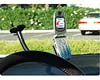
Over the next several years, mobile handsets will play an increasingly important role in portable navigation markets, with handset-based navigation devices reaching an annual sales volume of more than 96 million units by 2012. |
|
| The content herein, unless otherwise known to be public domain, are Copyright Space.TV Corporation. AFP and UPI Wire Stories are copyright Agence France-Presse and United Press International. ESA Portal Reports are copyright European Space Agency. All NASA sourced material is public domain. Additional copyrights may apply in whole or part to other bona fide parties. Advertising does not imply endorsement, agreement or approval of any opinions, statements or information provided by Space.TV Corp on any Web page published or hosted by Space.TV Corp. Privacy Statement |