 |
Paris (AFP) May 12, 2008 The violent quake that shook China's Sichuan province on Monday is linked to a shift of the Tibetan plateau to the north and east, specialists at the Paris Institute of Earth Physics told AFP. "There will certainly be many aftershocks," commented Paul Tapponnier, an expert on tectonics in the region that is prone to earthquakes. The quake, with a magnitude of 7.8, struck close to densely populated areas of Sichuan province and was felt across a swathe of southeast Asia. China's state-run Xinhua news agency quoted local disaster relief officials as saying 3,000 to 5,000 people were estimated to have died in just one district of Sichuan, Beichuan County. Earthquakes are frequent and deadly along the fringes of the Tibetan Plateau, which was raised when India collided into Eurasia, starting some 50 million years ago. It is this powerful thrust that created the Himalayas, towering at 8,848 metres with Mount Everest, the highest peak. The mountains continue to reach skyward to this day, propelled by unstable tectonic terrain. "Tibet is being pushed to the east. It is straddling southern China and locally the Sichuan bassin," said Tapponier. The quake that emanated in the Longmenshan margins of the Tibetan plateau "has a very complex geology," said Robin Laccassin, director of the tectonics department at the Institute. "There are many major fault lines... Some are ancient and they probably broke," said Laccassin. The deadliest earthquake to rock the Tibetan plateau in the 20th century was in 1920 when 230,000 people died in Gansu province. Another quake in Yunnan in the southwest left more than 15,000 dead in 1970. Related Links Tectonic Science and News
 Washington DC (SPX) Apr 29, 2008
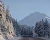
Geologists studying deposits of volcanic glass in the western United States have found that the central Sierra Nevada largely attained its present elevation 12 million years ago, roughly 8 or 9 million years earlier than commonly thought. The finding has implications not only for understanding the geologic history of the mountain range but for modeling ancient global climates. |
|
| The content herein, unless otherwise known to be public domain, are Copyright Space.TV Corporation. AFP and UPI Wire Stories are copyright Agence France-Presse and United Press International. ESA Portal Reports are copyright European Space Agency. All NASA sourced material is public domain. Additional copyrights may apply in whole or part to other bona fide parties. Advertising does not imply endorsement, agreement or approval of any opinions, statements or information provided by Space.TV Corp on any Web page published or hosted by Space.TV Corp. Privacy Statement |

