 |
Berlin, Germany (SPX) May 19, 2011 Nobody knows exactly how many people live in Istanbul, but there are thought to be about 15 million inhabitants of this city on two continents. Images from the German Aerospace Center (Deutsches Zentrum fur Luft- und Raumfahrt; DLR) TerraSAR-X radar satellite are giving urban planners a more accurate view of something slightly different - how much the city on the Bosphorus has spread out recently. Baedeker's handbook for travellers in 1914 sets out precise requirements: "The clothing one should wear when touring Asia Minor must be sure to include sturdy footwear." A piece of advice that still applies today if one wishes to explore Istanbul on foot. With an area of more than 1800 square kilometres, the Turkish city is occupying more and more space and is expanding into the hinterland with new neighbourhoods. In this image, acquired by the German TerraSAR-X radar satellite, the populated urban areas are coloured yellow. "In Istanbul, the city landscape is very compartmentalised and extremely heterogeneous," says Hannes Taubenbock of DLR's German Remote Sensing Data Center (Deutsches Fernerkundungsdatenzentrum; DFD). Urban sprawl is the name given to what happens around metropolises like Istanbul. "TerraSAR-X is helping to identify urban sprawl from space." The buildings in a city reflect the radar signals back to the receiving antenna significantly differently to undeveloped areas.
A look into the future "It's clear that the two Bosphorus bridges have contributed to this," says Taubenbock, explaining the urban development. Since 1973 the Bosphorus Suspension Bridge has connected the Asian side of the city to the European side, and in 1988 the Fatih Sultan Mehmet Bridge was added. "These connections to the city centre on the European side have generated enormous growth on the Asian side." The urbanisation snakes along the Bosphorus right down to the Black Sea. In the city itself, only a few areas remain undeveloped and are thus shown in green. This is the case on the headland where the Golden Horn, an inlet, extends into the European part. Having an exclusive panoramic view of the city and few neighbours, this is where the Topkapi Palace, the former residence and seat of government of the Sultans, is located. Even the ships that sail on the Sea of Marmara or the Bosphorus do not escape the 'radar eyes' of TerraSAR-X. "Over the last 35 years, the area of Istanbul has tripled," says Taubenbock. Such changes can best be followed and evaluated through comprehensive Earth observation. The data does not just help researchers identify urban sprawl. "We can also understand how a city is structured. How closely spaced are the buildings? What types of building are there? How many people live there?" To do this, it is necessary to gather more precise data about smaller areas on the ground, to determine the status of the housing and numbers of inhabitants. These data can then be combined with the Earth observation data and extrapolated to the entire city. "TerraSAR-X is an important source of data that can subsequently be assessed in greater detail by different disciplines." For Hannes Taubenbock, the analysis of cities such as Istanbul represents one thing above all else: "Megacities let us take a look into our future, when we have to expect that cities that today have 'only' two to five million inhabitants will grow at an explosive rate."
The TerraSAR-X mission The satellite travels around the Earth in a polar orbit and records unique, high-quality X-band radar data about the entire planet using its active antenna. TerraSAR-X works regardless of weather conditions, cloud cover or the absence of daylight and is able to provide radar data with a resolution down to one metre. DLR is responsible for using TerraSAR-X data for scientific purposes. It is also responsible for planning and implementing the mission as well as controlling the satellite. Astrium built the satellite and shares the costs of developing and using it. Infoterra GmbH, a subsidiary company founded specifically for this purpose by Astrium, is responsible for marketing the data commercially. Cutline for attached photo: The FalconLaunch T-1 rocket motor is test-fired at the Air Force Academy on May 16. The motor burned for 1.5 seconds and generated almost 1,500 pounds of thrust. Cadets will continue development of this rocket in the fall, in preparation for a 2012 launch, as part of a two-semester Astronautics capstone course.
Share This Article With Planet Earth
Related Links DLR Special: Earth Observation Earth Observation News - Suppiliers, Technology and Application
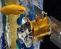
 NASA Mission Will Observe Earth's Salty Seas
Pasadena CA (SPX) May 18, 2011 Final preparations are under way for the June 9 launch of the international Aquarius/SAC-D observatory. The mission's primary instrument, Aquarius, will study interactions between ocean circulation, the water cycle and climate by measuring ocean surface salinity. Engineers at Vandenberg Air Force Base in California are performing final tests before mating Aquarius/SAC-D to its Delta II roc ... read more |
|
| The content herein, unless otherwise known to be public domain, are Copyright 1995-2010 - SpaceDaily. AFP and UPI Wire Stories are copyright Agence France-Presse and United Press International. ESA Portal Reports are copyright European Space Agency. All NASA sourced material is public domain. Additional copyrights may apply in whole or part to other bona fide parties. Advertising does not imply endorsement,agreement or approval of any opinions, statements or information provided by SpaceDaily on any Web page published or hosted by SpaceDaily. Privacy Statement |