|
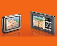
Las Vegas NV (SPX) Jan 21, 2009 Tele Atlas and Mio Technology have announced that Tele Atlas digital maps and content will be featured in all new Mio devices unveiled at CES 2009, the world's largest consumer electronics tradeshow. Mio's new line of GPS devices include the company's all-new Mio Spirit navigation software that enables users to get the most out of their GPS devices by delivering user-friendly map views, faster POI (point of interest) searches and fewer clicks to reach the information vital to the navigation experience. Mio's new GPS devices for North America - Mio Moov S556, Mio Moov S300, Mio Moov S500 and Mio Moov S700 - are pre-loaded with maps of the U.S. and Canada, more than 12 million POIs, and Text-to-Speech (spoken street names) in three languages, with additional languages available for download via the Mio More Desktop software. The devices also include Tele Atlas Brand Icons, which help enhance users' navigation experience by visually representing the POIs of participating businesses as instantly recognizable logos, so mobile consumers can accurately identify specific brands of interest. Additionally, the flat-panel Mio Moov S556 will incorporate Tele Atlas Junction Views, which clearly displays complex intersections by showing the areas in 3D, using arrows to indicate the proper driving lanes. "Our customers range from novice GPS users to travel enthusiasts who have relied on Mio for years, and we are committed to offering navigation devices that meet the needs of everyone by integrating the most comprehensive and intuitive digital maps and content," said Jerry Barbera, Vice President of Sales and Marketing, Mio Technology. "Through our partnership with Tele Atlas, we can empower our users to explore more with the freshest maps, developed through stringent processes and enhanced with community input and the latest content to add even more value to our newest devices." "As consumers continue to seek more content and features such as connectivity from their GPS devices, Mio differentiates its devices with new content and enhanced software features, delivering a complete navigation experience," said Jude McColgan, Vice President of Consumer Markets, Tele Atlas. "Through our community input and advanced map content features, we look forward to expanding Tele Atlas' work with Mio as it enhances its innovative product offerings and delivers positive consumer experiences to the marketplace." Related Links Tele Atlas GPS Applications, Technology and Suppliers
 Las Vegas NV (SPX) Jan 20, 2009
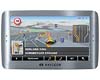
Rand McNally has announced that it has licensed Rand McNally Scenic Routes and City Guides for NAVIGON's line of personal navigation devices (PNDs). Available Spring 2009, NAVIGON becomes the first company in the GPS industry to provide Rand McNally's well known Best of the Road content. |
|
| The content herein, unless otherwise known to be public domain, are Copyright Space.TV Corporation. AFP and UPI Wire Stories are copyright Agence France-Presse and United Press International. ESA Portal Reports are copyright European Space Agency. All NASA sourced material is public domain. Additional copyrights may apply in whole or part to other bona fide parties. Advertising does not imply endorsement, agreement or approval of any opinions, statements or information provided by Space.TV Corp on any Web page published or hosted by Space.TV Corp. Privacy Statement |