|
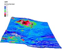
Columbus OH (SPX) Dec 12, 2007 New software is helping NASA find safe places for the Spirit rover to ride out future Martian winters -- and also plan where Spirit and its companion rover, Opportunity, will explore in the future. The steep Martian mesa dubbed "Von Braun" would be a safe haven, the software and data analysis determined -- but the path that Spirit would have to follow to get there is a little too risky to travel with winter on the way, explained Ron Li, professor of civil and environmental engineering and geodetic science at Ohio State University. That's one reason why Spirit is currently headed to the northern rim of a depression called "Home Plate" for the winter -- though, as of early December, it was rolling through loose soil that was hampering its progress. Li and his research team are developing several software programs to help the rovers navigate. The latest program used satellite images, as well as rover images, to determine that Von Braun's more than 25-degree incline is steep enough for the rover's solar panels to gather critical energy from the low winter sun. But it also determined that there are no safe winter sites on the route to Von Braun where the rover could hide out in a pinch. Should Spirit set out on the 400-foot journey to Von Braun and not be able to reach it, there are not enough bail out spots along the route where it could take refuge, the software found. Even in ideal driving conditions, the trip would take a number of days. And with the winter approaching, Spirit might need to stop at steep slopes where it could better angle its solar panels to gather light. "Once we identified Von Braun as a good winter site, our job was to help the rover find a safe path there from Home Plate, and identify a few 'bail out' spots in case anything happened in between," Li said. "But we couldn't find any bail out spots with a steep enough slope." The Ohio State software uses images from the High Resolution Imaging Science Experiment (HiRISE) camera onboard the Mars Reconnaissance Orbiter. It compares those images to panoramas taken by the rovers on the ground to precisely map features on the surface. Li described the software Wednesday, December 12, 2007, in a poster session at the American Geophysical Union meeting in San Francisco . Previously, his team used similar software to map Opportunity's path as it descended into Victoria Crater. The new software does more, by helping scientists identify Martian surface features that the rovers can investigate. "HiRISE gives us 0.3-meter (one foot) resolution on the ground, so we can combine those orbital images with ground images to identify rocks from the orbiter and the ground," Li said. The key, he said, is to combine panoramas taken by the rovers to give a wide view of the terrain. The rover takes one panorama, then travels a distance from several feet to 300 feet, depending on the terrain and tasks it's performing at the time. The software combines two or more rover panoramas in a way analogous to how our brain combines the images from our left eye and right eye to give us a stereo view of our surroundings. Only the software is able to calculate where features on the landscape are located, and match them to features on HiRISE images at high accuracy. One of the new functions of the software is this so-called wide baseline stereo. "It's as if the rover had a baseline view that was bigger than the rover itself," Li said. The Mars Exploration Rover team expects it may find some very interesting geologic features on Von Braun, so Spirit may travel there next year -- after winter's danger has passed. This continuing research is funded by NASA. The Ohio State scientists are working to further develop the software so that future rovers can use it to navigate automatically. In the meantime, they have joined the European Space Agency mission ExoMars, which will launch a Mars mission with a rover of its own in 2013. Li will be working on the science team for the PanCam instrument, which will let the ExoMars rover take 3D panoramas of the red planet. Related Links Mars News and Information at MarsDaily.com Lunar Dreams and more
 Pasadena CA (JPL) Dec 11, 2007
Opportunity spent part of the past week carefully grinding a hole into the surface of a light-colored ring of rock inside "Victoria Crater" known as "Smith," despite the previous loss of encoders that enabled two of the motors of the rock abrasion tool to operate under control of the tool's flight software. |
|
| The content herein, unless otherwise known to be public domain, are Copyright Space.TV Corporation. AFP and UPI Wire Stories are copyright Agence France-Presse and United Press International. ESA Portal Reports are copyright European Space Agency. All NASA sourced material is public domain. Additional copyrights may apply in whole or part to other bona fide parties. Advertising does not imply endorsement, agreement or approval of any opinions, statements or information provided by Space.TV Corp on any Web page published or hosted by Space.TV Corp. Privacy Statement |