|
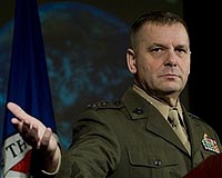
Special to American Forces Press Service Washington DC (SPX) Feb 14, 2009 The collision yesterday of two communication satellites has left a debris pattern that may affect future space operations, the vice chairman of the Joint Chiefs of Staff said at a symposium co-sponsored by the George C. Marshall Institute and the U.S. Chamber of Commerce's Space Enterprise Council. U.S. Marine Gen. James E. Cartwright, speaking on the national security ramifications of the collision between an American and a Russian satellite, said the event shows the need for better information sharing and space situational awareness. The American satellite, owned by Iridium Satellite of Bethesda, Md., weighed about 1,200 pounds and collided with a Russian satellite that had been nonoperational for more than a decade. The crash happened 491 miles above Siberia. The collision was confirmed when the active U.S. satellite did not report in and the debris field was picked up by sensors. "My worry is that debris field is going to be up there for about a year, so we're going to have to play a little bit of dodgeball," Cartwright said. "It's going to be a problem because it will take a month or two for the debris to settle down and for us to understand the scope of the field to be able to track it and understand where at least the larger objects are." The debris will be around for some time because the satellites were in a high orbit around the earth, Cartwright said. Once the debris field has stabilized, there will be a pattern that all countries can use to navigate around, he said. "It's a field of debris out there that's going to be out there for many years," he said. "The good news is once it's stabilized, it's relatively predictable. The bad news is, it's a large area. If we're denied that large area for use, it becomes a problem." Many of the commercial and national security satellites, particularly communications satellites, rely on certain spacing between other objects in order to be effective, Cartwright said. Losing a spot because of debris could have a financial or operational impact on anyone wanting to use the space, he said. "If that's going to be long term, that's a problem for us," he said. The general said he hopes the incident will result in a better exchange of satellite orbit data between countries. "I'd like to be able to find a way, not only with Russia, but with other nations to make sure that our exchange of data is more complete," he said. "We would be remiss to not take advantage of this and turn it into good." The growing number of satellites require improved information sharing, Cartwright said. "It is a crowded place out there today," he said. "There is just no way around that. The need, first and foremost, for better situational awareness out there is something you have to actively pursue." The need for space situational awareness has changed drastically in recent years, the general said. "It was acceptable five years ago to know something was out there and check on it every couple weeks," he said. "Those days are just not tolerable anymore." Whereas countries previously could wait a few days or weeks to get satellites stabilized in their orbits, the current congestion in space pushes that timeframe down to seconds and minutes, he said. Related Links Marine Corps Gen. James E. Cartwright Military Space News at SpaceWar.com
 Woodland Hills CA (SPX) Feb 13, 2009
Northrop Grumman has been competitively selected by General Dynamics Robotic Systems to supply the navigation system solution for the Phase II Global Positioning System (GPS) / Inertial Navigation System (INS), a major component of the Autonomous Navigation System (ANS) for the U.S. Army's Future Combat Systems (FCS) program. |
|
| The content herein, unless otherwise known to be public domain, are Copyright Space.TV Corporation. AFP and UPI Wire Stories are copyright Agence France-Presse and United Press International. ESA Portal Reports are copyright European Space Agency. All NASA sourced material is public domain. Additional copyrights may apply in whole or part to other bona fide parties. Advertising does not imply endorsement, agreement or approval of any opinions, statements or information provided by Space.TV Corp on any Web page published or hosted by Space.TV Corp. Privacy Statement |