Space Industry and Business News  
Robotic helicopters teach themselves

The researchers had Oku and other pilots fly entire air show routines while every movement of the helicopter was recorded. As each maneuver was repeated, the helicopter's trajectory inevitably varied slightly with each flight. But the learning algorithms created by Ng's team were able to discern the ideal trajectory the pilot was seeking.
by Staff Writers
Stanford, Calif. (UPI) Sep 3, 2008
U.S. scientists say they have created robotic helicopters that can teach themselves to fly by "watching" other helicopters.

Stanford University Professor Andrew Ng, who led the project, said the achievement is an important demonstration of "apprenticeship learning," in which robots use an artificial intelligence system to learn by observing an expert, rather than by having software engineers write instructions.

Stanford's artificial intelligence system learned how to fly by "watching" a four-foot-long helicopter flown by expert radio control pilot Garett Oku.

While it might seem an autonomous helicopter could fly stunts by simply replaying the exact finger movements of an expert pilot using joy sticks on a remote controller, Ng said that's not possible due to many uncontrollable variables such as gusting winds.

So the researchers had Oku and other pilots fly entire air show routines while every movement of the helicopter was recorded. As each maneuver was repeated, the helicopter's trajectory inevitably varied slightly with each flight. But the learning algorithms created by Ng's team were able to discern the ideal trajectory the pilot was seeking.

Ng said there is interest in using autonomous helicopters for such duties as searching for land mines or mapping wildfire hot spots in real time.

Related Links
UAV News - Suppliers and Technology


Memory Foam Mattress Review
Newsletters :: SpaceDaily :: SpaceWar :: TerraDaily :: Energy Daily
XML Feeds :: Space News :: Earth News :: War News :: Solar Energy News


LockMart Demos Airspace Deconfliction Of Multiple UAVs
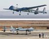
Cherry Hill NJ (SPX) Aug 28, 2008
Lockheed Martin's Unmanned Aerial Vehicle Airspace Management System (UAMS) solved one of the more difficult challenges facing military services and their industry partners by successfully demonstrating the ability to deconflict groups of in-flight UAVs during a test near Pittsburgh, PA.


  • Hypertext Hits Print: The Future Of Books
  • Carnegie Mellon System Thwarts Internet Eavesdropping
  • Tiny nation of Niue gets laptop for every child
  • 'Phoney' queues used to spur Polish iPhone launch

  • GeoEye-1 Satellite Launch Delayed Due To Hurricane Hanna
  • Arianespace To Launch Koreasat 6
  • Inmarsat Selects ILS Proton To Launch S-Band Satellite For Europe
  • Forecast International Projects 50 Billion Dollar ELV Market

  • Chinese airlines fly into headwinds in Olympic year
  • The M2-F1 - An Aircraft Without Wings
  • China's Tianjin building runway for Airbus test flights: report
  • NASA evaluates new wing sensor

  • DataPath Wins Suppport Contract For US CENTCOM SatComm Hubs
  • Satellite's Data Collection Will Support Warfighter
  • Boeing Awarded E-6B Upgrade Contract
  • Defense Support Program Satellite Decommissioned

  • An Interview With Michael Fehringer GOCE System Manager
  • Film created to protect small spacecraft
  • North Korea marks long-range missile test
  • Eyes turn to dawn of 'visual computing'

  • Orbital Appoints Frank Culbertson And Mark Pieczynski To Management
  • Chris Smith Named Director Of Cerro Tololo Inter-American Observatory
  • AsiaSat Appoints New General Manager China
  • NASA names aeronautics administrator

  • Ball Aerospace Begins Integration Of WorldView-2 Imaging Instrument
  • Hanna Not Moving Much Near North Of The Caicos Islands
  • Arctic Ice On The Verge Of Another All-Time Low
  • Changing The World, One Student At A Time

  • The Cleanest, Greenest Courier in London is E-lectric
  • OnStar Opens Crisis Assist Emergency Services For Gustav Victims
  • Rockford Map Publishers Selects TerraGo To Enhance Plat Books
  • u-blox GPS Technology To Power Microsoft MapPoint 2009 USB Stick

  • The content herein, unless otherwise known to be public domain, are Copyright Space.TV Corporation. AFP and UPI Wire Stories are copyright Agence France-Presse and United Press International. ESA Portal Reports are copyright European Space Agency. All NASA sourced material is public domain. Additional copyrights may apply in whole or part to other bona fide parties. Advertising does not imply endorsement, agreement or approval of any opinions, statements or information provided by Space.TV Corp on any Web page published or hosted by Space.TV Corp. Privacy Statement