|
Sunnyvale CA (SPX) May 02, 2008 Trimble has introduced the first modern software package specifically designed to continuously monitor and control Differential Global Positioning System (DGPS) broadcast sites for marine navigation -- Trimble Coastal Center software. Developed to provide network operators the ability to monitor and control multiple DGPS beacon stations from one central location, Trimble Coastal Center software can save time by automating functions and tasks remotely. Built on a modern, open architecture, Trimble Coastal Center software is scalable and adaptable to meet a wide variety of DGPS provider network configurations ranging from one site to hundreds of broadcast sites. It can also adapt to different configurations and architectures within the same DGPS provider network. In addition, operators can customize the configuration of monitors, alarms and reports by specifying the exact conditions to meet their particular needs. Trimble Coastal Center software is the only solution that offers pre-broadcast integrity. Post-broadcast integrity is available for additional redundancy, security and data archiving functions. The software package has extended beacon almanac features and a high level of reporting capabilities. Trimble Coastal Center is also the only beacon monitoring software designed using standards of the International Convention of Safety of Life at Sea (SOLAS), an internationally-recognized treaty protecting the safety of merchant ships. "Trimble Coastal Center software represents the future of Trimble's DGPS coastal solutions products for SOLAS," said Pierre Desjardins, business manager for Trimble's GNSS Infrastructure business area. "Operators can significantly increase their efficiency and productivity as well as improve their overall supervision over the entire beacon network because of the ability to perform network monitoring and maintenance functions remotely." Designed to enhance the modernization of legacy DGPS systems, the Coastal Center software is hosted on a platform common to other Trimble products and offers a bridge to future differential satellite-based positioning systems and capabilities. The Coastal Center software supports conventional communications systems such as RS-232 and 422, as well as modern network communication standards. Depending upon user network design and system requirements, Trimble Coastal Center software can operate on a single PC-based platform or it can be distributed across several computers. With Trimble Coastal Center, users can view all beacon sites from any licensed workstation throughout the network. Offering all control station messages required under the RSIM 1.1 and the new RSIM 1.2 standards, the Trimble Coastal Center software provides a highly configurable alarming system that interfaces with email and/or pager systems immediately notifying key personnel of up-to-the-minute system conditions, even those at the most remote locations. With its extensive event and message logging capabilities, combined with XML-based report generation, user- customized reports can be easily generated. Related Links Trimble GPS Applications, Technology and Suppliers
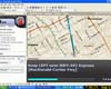 Redmond WA (SPX) May 02, 2008
Microsoft has introduced two new products to help photographers manage their digital photos in a new way using location data, a process known as geotagging. Geotagging is an exciting new way to organize your digital photos that was previously available only to those with technical expertise. Microsoft Pro Photo Tools make geotagging available for all photographers and can be downloaded for free at the Microsoft Pro Photo Web site. |
|
| The content herein, unless otherwise known to be public domain, are Copyright Space.TV Corporation. AFP and UPI Wire Stories are copyright Agence France-Presse and United Press International. ESA Portal Reports are copyright European Space Agency. All NASA sourced material is public domain. Additional copyrights may apply in whole or part to other bona fide parties. Advertising does not imply endorsement, agreement or approval of any opinions, statements or information provided by Space.TV Corp on any Web page published or hosted by Space.TV Corp. Privacy Statement |