|
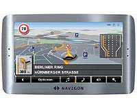
Las Vegas NV (SPX) Jan 21, 2009 Rand McNally has announced that it has licensed Rand McNally Scenic Routes and City Guides for NAVIGON's line of personal navigation devices (PNDs). Available Spring 2009, NAVIGON becomes the first company in the GPS industry to provide Rand McNally's well known Best of the Road content. "Rand McNally has long been counted on to deliver outstanding and relevant travel content. By leveraging our superior mapping technology into location-based devices, we are enabling consumers to enhance their driving experience," said Donna Koppensteiner, vice president for Rand McNally. "We appreciate working with industry innovators like NAVIGON to bring relevant content to the consumer where and when they need it." Rand McNally's Scenic Routes and City Guides provide comprehensive travel information to aide NAVIGON device owners during the trip planning process and while they are on the road. Scenic Routes provides more than 250 scenic routes and pre-planned trips with coverage in all 50 states and Canada for travelers searching for routes featuring the most beautiful vistas and landscapes. Rand McNally City Guides provide information on the best attractions and landmarks for more than 1400 US and Canadian cities. "As the most respected company in the mapping, routing and geographic reference industry, Rand McNally is a perfect partner to continue our tradition of bringing innovation to the GPS market and delivering features that are relevant to the navigation experience" said Michael Roach, NAVIGON's president for the Americas. Rand McNally Scenic Routes include: - Best of the Road. Rand McNally's famous series of scenic driving trips information on dining, attractions and lodging. - Weekend Getaways. Trips developed for quick getaways to all areas of the country. - Scenic Tours. Driving tours, highlighting visually appealing roads and attractions in the US and Canada. - Regional Trips. In-depth tours of culturally distinct, geographically compact areas. Rand McNally City Guides include: - Detailed City Guides. Overviews of the most visited attractions, museums and landmarks, plus nightlife spots. - National Coverage. More than 1400 cities with coverage in all 50 US states and Canada. Related Links NAVIGON Rand McNally GPS Applications, Technology and Suppliers
 Las Vegas NV (SPX) Jan 21, 2009
Tele Atlas and Mio Technology have announced that Tele Atlas digital maps and content will be featured in all new Mio devices unveiled at CES 2009, the world's largest consumer electronics tradeshow. |
|
| The content herein, unless otherwise known to be public domain, are Copyright Space.TV Corporation. AFP and UPI Wire Stories are copyright Agence France-Presse and United Press International. ESA Portal Reports are copyright European Space Agency. All NASA sourced material is public domain. Additional copyrights may apply in whole or part to other bona fide parties. Advertising does not imply endorsement, agreement or approval of any opinions, statements or information provided by Space.TV Corp on any Web page published or hosted by Space.TV Corp. Privacy Statement |