 |
Superior CO (SPX) May 06, 2011 Making use of Earth remote sensing satellites to help monitor and perhaps defuse conflict is among the topics presented in the Spring 2011 issue of Imaging Notes magazine - a unique publication devoted to Earth remote sensing for security, energy and the environment. Highlighted in the latest Imaging Notes is the Satellite Sentinel Project, spearheaded by Hollywood actor and activist, George Clooney - an initiative to keep a close eye via commercial satellites on border tensions between South and North Sudan.
Leveraging the 'information cloud' "This data shift enables people to contribute data from the field and to incorporate social media and live feeds for disaster response, such as the devastating earthquake and resulting tsunami in Japan," Yoo explains. The Satellite Sentinel Project and the article, "The Web of Geospatial Collaboration" illustrate this point, Yoo says. "They include a focus on leveraging the 'information cloud' to respond to real-time needs, such as event-specific, time-specific, and location-specific natural events." Also spotlighted in the Spring 2011 issue of Imaging Notes: Use of airborne Laser Detection and Ranging technology as a tool for plotting out the archeology of forested areas around the world; how communities eclipse governments in mapping the world thanks to a web of geospatial collaboration; and an informative look from "down under" as International Space University students meet in Australia to discuss, among a range of topics, Earth observation for the benefit of all nations.
Utility of space technologies "A central focus of our Foundation centers on strengthening or developing the policies and institutions that improve the utility of space technologies in support of human and environmental security needs," Williamson said. "We are pleased to be a partner with Imaging Notes to help support our objectives."
Share This Article With Planet Earth
Related Links Secure World Foundation Earth Observation News - Suppiliers, Technology and Application
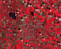 Esri and DOI Introduce Landsat Data for the World
Redlands CA (SPX) May 04, 2011 Working in close collaboration with the US Department of the Interior (DOI), Esri is pleased to announce the release of Landsat image services. These provide access to almost four decades' worth of Global Land Survey (GLS) Landsat data developed by the National Aeronautics and Space Administration (NASA) and DOI's US Geological Survey. Esri provides access to the full multispectral, multit ... read more |
|
| The content herein, unless otherwise known to be public domain, are Copyright 1995-2010 - SpaceDaily. AFP and UPI Wire Stories are copyright Agence France-Presse and United Press International. ESA Portal Reports are copyright European Space Agency. All NASA sourced material is public domain. Additional copyrights may apply in whole or part to other bona fide parties. Advertising does not imply endorsement,agreement or approval of any opinions, statements or information provided by SpaceDaily on any Web page published or hosted by SpaceDaily. Privacy Statement |


 del.icio.us
 Digg
Digg Reddit
 YahooMyWeb
 Google