|
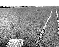
Pasadena CA (JPL) Feb 13, 2007 Opportunity has completed a remote sensing campaign at "Cape Desire" and is on the move to the next promontory, called "Cabo Corrientes." Opportunity's odometer rolled past 10 kilometers (6.2 miles) during the 50.51-meter (166 feet) drive on sol 1080. By contrast, the NASA Level 1 requirements for the mission called for achieving at least 600 meters (1,969 feet) with one rover, and the mission design requirement was for 1,000 meters (3,281 feet). This is another significant milestone for Opportunity, and yet another testimony to the outstanding work done by the development and operations teams. Sol-by-sol summary Each sol, the panoramic camera assesses atmospheric opacity ("tau") at the beginning of the sol's sequence of activities and again before the afternoon Mars Odyssey pass. The miniature thermal emission spectrometer scans sky and ground during the Odyssey pass. That instrument also observes sky and ground each morning as part of the preceding sol's activity plan, just prior to Spirit beginning the current sol's sequence. Sol 1077: Opportunity conducted panoramic camera 13-filter targeting on "Cabo Anonimo." The rover then used its miniature thermal emission spectrometer to stare at: rover tracks, at scuffed soil, at the area near the tracks and at Cabo Anonimo. The navigation camera took images to support the work by the miniature thermal emission spectrometer on and near the tracks. The panoramic camera also did a 13-filter examination of Cabo Corrientes. After the Odyssey pass, the rover conducted an argon experiment during six hours of collecting data with the alpha particle X-ray spectrometer. Sol 1078: Opportunity drove 42.81 meters (140 feet) away from Cape Desire and then performed an update of its orientation. Post-drive imaging included navigation and panoramic camera mosaics. There was no science activity around the afternoon Odyssey pass on this sol because the team decided to use the energy to support an overnight UHF pass. Sol 1079: The miniature thermal emission spectrometer completed a seven-point sky and ground analysis, the navigation camera looked for clouds, and then the rover completed two miniature thermal emission spectrometer sky and ground stares. Sol 1080: The rover drove 50.51 meters (166 feet), then collected images for mosaics with the navigation and panoramic cameras. There was another morning UHF pass in the 1080 plan, so no science activity was conducted around the afternoon Odyssey pass. Sol 1081: In the morning of this sol, a panoramic camera horizon survey was conducted. The navigation camera looked for clouds and then the miniature thermal emission spectrometer conducted a seven-point analysis of sky and ground. During the afternoon Odyssey pass, that instrument completed a five-point sky and ground analysis. Sol 1082: The plan included a checkout of new autonomous navigation software during a drive toward Cabo Corrientes. Planned imaging after the drive included mosaics by the navigation and panoramic cameras. The rover's panoramic camera was instructed to view the Martian moon Phobos. Sol 1083 (Feb. 9, 2007): The plan for this sol calls for the panoramic camera to have a look at the sky in the morning. The navigation camera will then look for clouds and the miniature thermal emission spectrometer will conduct a seven-point sky and ground analysis. In the afternoon, the rover will have another chance to see Phobos in the sky. As of sol 1080 (Feb. 6, 2007), Opportunity's total odometry was 10,023.19 meters (6.23 miles). Related LinksMars Rovers at JPL Mars Rovers at Cornell Mars News and Information at MarsDaily.com Mars News and Information at MarsDaily.com Lunar Dreams and more
 Pasadena CA (JPL) Feb 12, 2007
Spring is in the thin, Martian atmosphere once again as NASA's Mars Exploration Rover Spirit scans the local terrain for dust devils expected this time of year. The rover remains healthy and has completed remote sensing studies of a soil target known as "Tyrone," conducted from a distance of about 10 meters (33 feet) away. Tyrone has bright soil upturned in wheel tracks. |
|
| The content herein, unless otherwise known to be public domain, are Copyright Space.TV Corporation. AFP and UPI Wire Stories are copyright Agence France-Presse and United Press International. ESA Portal Reports are copyright European Space Agency. All NASA sourced material is public domain. Additional copyrights may apply in whole or part to other bona fide parties. Advertising does not imply endorsement, agreement or approval of any opinions, statements or information provided by Space.TV Corp on any Web page published or hosted by Space.TV Corp. Privacy Statement |