|
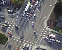
Minneapolis MN (SPX) Apr 10, 2008 ObjectFX has announced that it has released its newest 3.0 version of Spatial Rules, as part of the growing suite of ObjectFX geospatial software. Spatial Rules is a service-oriented middleware component designed to manage streams of spatial and temporal data generated by location-aware devices, sensors, and other automated and manual collection systems. Traditional Geographic Information Systems (GIS) vendors have failed to address the need for a scalable, open framework for spatiotemporal rule creation and processing, leaving most customers with the need to develop custom or "one-off" solutions that are expensive to build, difficult to maintain and not scalable. Spatial Rules 3.0 strengthens the company's ability to help customers intelligently manage the flood of location-based information that faces many organizations in government and the private sector. Spatial Rules customers include commercial transportation and supply chain logistics; government homeland security, logistics and law enforcement; military blue/red force tracking and situational awareness; and intelligence gathering and monitoring. ObjectFX Spatial Rules is designed to continuously analyze large volumes of timestamped location data and to transform the data into usable information. Examples include monitoring vehicles to detect when they enter or exit an area of interest, veer off-route, or move within proximity to a landmark. Cluster analysis indicates when certain types of objects gather near each other. Geofence monitoring and proximity to areas of interest can be done in two or three dimensions to establish threat zones, monitor airspace, or detect transitions across checkpoints on the ground, at altitude, or below sea-level. Areas and corridors can be monitored for undesirable activity or to warn when severe weather approaches work zones, crews, or convoys. New features in Spatial Rules 3.0 include: - Dynamic cluster detection used to recognize when objects or events within an area reach a specified density threshold. Ability to treat points, lines or polygons as "locatables" (i.e., dynamic objects that are tracked). - Three-dimensional features based on a highly scalable "two-and-a-half" dimension geometry model used in the gaming industry. - Support for 3D distance calculations, including line-of-sight and great circle options. - Built-in support for a broad range of input formats, including: Open Geospatial Consortium (OGC) Geography Markup - Language (GML), ESRI Shapefiles, Google Earth KML and GeoRSS. - Support for the OGC Feature Encoding Specification Version 1.2 for expressing rule logic. - Support for new rule predicates, including traverses, closeTo, interacts and inCluster. "We are seeing huge new demand for high-throughput spatiotemporal business rules in the commercial industries that we target," said Nick Thomey, President, ObjectFX. "All of that is in addition to the growing volume of government and military applications already using our Spatial Rules engine." "Spatial Rules 3.0 will provide our customers with an even more flexible and easy-to-use way to build spatial and temporal rules into their integrated solutions, thereby improving their spatially-enabled applications and shortening their product delivery times," Thomey continued. Spatial Rules 3.0 is designed to work either by itself in a spatiotemporal application or side by side with other business rules engines and can be purchased as an independent product or as a complement to SpatialFX, the geospatial software platform from ObjectFX. Related Links ObjectFX GPS Applications, Technology and Suppliers
 Moscow, April 9, 2008
 The council of chief designers responsible for commissioning Russia's Global Navigation Satellite System has said it will only become operational in late 2008, whereas the previous deadline was Dec. 31, 2007. |
|
| The content herein, unless otherwise known to be public domain, are Copyright Space.TV Corporation. AFP and UPI Wire Stories are copyright Agence France-Presse and United Press International. ESA Portal Reports are copyright European Space Agency. All NASA sourced material is public domain. Additional copyrights may apply in whole or part to other bona fide parties. Advertising does not imply endorsement, agreement or approval of any opinions, statements or information provided by Space.TV Corp on any Web page published or hosted by Space.TV Corp. Privacy Statement |