 |
Rolling Meadows IL (SPX) Sep 20, 2007 Northrop Grummansuccessfully demonstrated an advanced targeting data link using the Defense Advanced Research Project Agency's (DARPA) Quint Network Technology (QNT). This achievement was accomplished as part of a cooperative effort between the U.S. Air Force's (USAF) Electronics System Center (ESC), DARPA, Northrop Grumman and Rockwell Collins. DARPA's QNT program is jointly funded with the USAF's Global Cyberspace Integration Center (GCIC), ESC, Air Force Research Laboratory (AFRL) and the U.S. Navy. The demonstration occurred in conjunction with ESC's Laser Target Imaging Program and "Bold Quest," a U.S. Joint Forces Command-sponsored military exercise. Installed in a Northrop Grumman LITENING AT targeting system, the QNT data link provided encrypted, bi-directional airborne transmission of streaming video, and bi-directional cursor-on-target metadata-tagged still imagery, both at full sensor resolution allowing ground forces to receive imagery and its associated geo-positional data for battlefield situational awareness, aircraft position, sensor point of interest and target selection. Using advanced waveforms and forward error correction coding, packetized video and metadata connections were maintained at ranges that exceeded 50 nautical miles. These ranges were achieved using omni-directional antennas on both the airborne and ground nodes allowing both the pilot and ground forces to operate without having to point directional antennas at each other thereby increasing tactical flexibility. In addition to using the advanced Tactical Targeting Network Technology's Small Form Factor waveform, the demonstrated link employs a service-oriented architecture. This architecture was cooperatively developed by Northrop Grumman and Air Force Special Operations Command operational and technical personnel from Hurlburt and Wright-Patterson Air Force Bases. The architecture uses multicast transmissions over the QNT link such that each node in the network publishes its available services as such streaming video, still imagery, and a number of situational awareness updates from the ground and air nodes from which users can select. This eliminates the need for the user to deal with internet protocol addresses and other network functions and allows the user to focus instead on mission needs and execution. "The government-industry LITENING team has now demonstrated the longest range secure network transmission of video and associated metadata from a targeting and sensor system," said Mike Lennon, vice president of Targeting and Surveillance programs for Northrop Grumman's Defensive Systems Division. "Combined with our LITENING 4th Generation system currently transitioning into production, our warfighters will have unprecedented situational awareness and target coordination as the Air Force moves forward with fielding a QNT network." Northrop Grumman's widely fielded LITENING AT system is a self-contained, multi-sensor weapon-aiming system that enables aircrews to detect, acquire, auto-track and identify targets for highly accurate delivery of both conventional and precision-guided weapons. LITENING AT features advanced image processing for target identification; coordinate generation for GPS weapons; a new 1,024 x 1,024 pixel charge-coupled device television sensor; a laser spot tracker; and an infrared laser marker. The LITENING 4th Generation system will add the most advanced 1,024 x 1,024 pixels (1k x 1k) FLIR sensor for improved target detection and recognition ranges under day and night conditions; new sensors for improved target identification; and other advanced target recognition and identification features. To date, almost 500 LITENING AT pods have been ordered by the U.S. forces and allied nations. More than 400 systems have been fielded, the largest number of any advanced targeting and sensor system. LITENING AT is combat proven on AV-8B, A-10, B-52, F-15E, F-16 and F/A-18 aircraft. Together, all variants of the LITENING pod have amassed more than 720,000 flight hours, approximately half of which have been logged under deployed and combat conditions. The LITENING targeting system is currently deployed with the Air Force's Air Combat and Air Force Reserve Commands, U.S. Air National Guard and the U.S. Marine Corps, as well as allied users. Related Links Military Space News at SpaceWar.com
 Vancouver, Canada (AFP) Sept 14, 2007
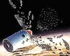
Human security and technologies from cell phones to weather forecasts are more at risk than ever from anti-satellite weapons and space junk, said a research report released Friday. |
|
| The content herein, unless otherwise known to be public domain, are Copyright Space.TV Corporation. AFP and UPI Wire Stories are copyright Agence France-Presse and United Press International. ESA Portal Reports are copyright European Space Agency. All NASA sourced material is public domain. Additional copyrights may apply in whole or part to other bona fide parties. Advertising does not imply endorsement, agreement or approval of any opinions, statements or information provided by Space.TV Corp on any Web page published or hosted by Space.TV Corp. Privacy Statement |
