|
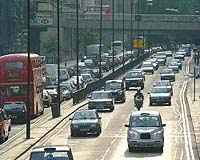
San Diego CA (SPX) Feb 18, 2008 Networkcar has announced that the Alabama Department of Environmental Management (ADEM) has selected Networkfleet as its fleet management solution to wirelessly monitor GPS location, engine diagnostics and emissions for its entire fleet. Networkfleet combines GPS location with diagnostic monitoring to allow fleet managers to improve the productivity and efficiency of their fleet operations. ADEM administers all major federal environmental laws, including the Clean Air, Clean Water and Safe Drinking Water acts and federal solid and hazardous waste laws. Networkfleet is being installed to monitor ADEM's fleet of sedans and light duty trucks that are used in conducting field inspections. ADEM worked with AllComm Wireless, Inc., a Networkcar reseller in Montgomery, Ala., in the selection and installation process. "Networkfleet was the only system we found that continuously monitors the performance of the vehicle and reports failures in the emissions control system," said Aubrey White, general services branch chief for ADEM. "As we are an environmental agency, it was especially important to us that the system report emissions problems immediately so that they can be identified and repaired." Networkfleet is widely used by commercial and government fleets, including city, county, state and federal agencies. Since Networkfleet connects directly to a vehicle's on-board diagnostic (OBD-II) port, it dynamically measures and reports on the status of a vehicle's emission control system and monitors excess idle time to reduce emissions. It can also determine precise information such as actual vehicle speed and miles-per-gallon. Fleet managers login to a secure Web site to view vehicle performance data and can receive reports emailed directly to their in-box daily, weekly, or monthly. "Emissions monitoring is becoming a more important aspect of fleet management as states implement laws to reduce vehicle emissions," said Keith Schneider, president of Networkcar. "Networkfleet's emission monitoring not only reduces air pollution, it also lowers maintenance costs and increases fuel efficiency by uncovering faulty emissions systems early." Related Links Networkcar GPS Applications, Technology and Suppliers
 San Diego CA (SPX) Feb 18, 2008
Designed to provide dog owners with a convenient, easy-to-use, real-time solution to locate and recover their missing pets, Zoombak has introduced its Advanced GPS Locator at the Global Pet Expo 2008. Global Pet Expo is the pet industry's largest annual trade show. At the event, Zoombak demonstrated the many features of its advanced GPS dog locator to attending industry buyers and members of the media. |
|
| The content herein, unless otherwise known to be public domain, are Copyright Space.TV Corporation. AFP and UPI Wire Stories are copyright Agence France-Presse and United Press International. ESA Portal Reports are copyright European Space Agency. All NASA sourced material is public domain. Additional copyrights may apply in whole or part to other bona fide parties. Advertising does not imply endorsement, agreement or approval of any opinions, statements or information provided by Space.TV Corp on any Web page published or hosted by Space.TV Corp. Privacy Statement |