. Space Industry and Business News .


.
FIRE STORM
NASA Spacecraft Sees Wind-Whipped Fires in East Texas
by Staff Writers
Pasadena CA (JPL) Sep 08, 2011

NASA's MISR instrument on its Terra spacecraft captured this image of wildfires burning throughout eastern Texas on Sept. 5, 2011. Credit: NASA/GSFC/LaRC/JPL, MISR Team.

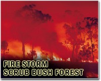
As most of Texas continues to experience the worst one-year drought on record, more than 170 wildfires have erupted across the Lone Star State so far this month alone. The Texas Forest Service reports the past week's blazes have charred more than 135,000 acres and destroyed more than 1,000 homes.

Strong, gusty winds on the western side of Tropical Storm Lee, which passed over Louisiana on Monday, Sept. 5, 2011, stoked the fires burning throughout eastern Texas. The Multi-angle Imaging SpectroRadiometer (MISR) instrument on NASA's Terra spacecraft passed over the wildfires at 12:05 p.m. CDT on Sept. 5. At that time, temperatures were around 80 degrees Fahrenheit (27 degrees Celsius), with winds from the north gusting to 25 mph (40 kilometers per hour).

This image is a blend of data from MISR's vertical-viewing camera, which provides the sharpest view of surface features, and data acquired at a view angle of 70 degrees, which accentuates the appearance of smoke plumes generated by the fires.

The Bear Creek Fire north of Marshall, near the top center of the image, is the largest fire in the image. When this image was acquired, the fire had charred 30,000 acres and was 0 percent contained. To the west is the Diana Fire, just north of Longview, and the Henderson-502 Fire, northwest of Nacogdoches.

The combined smoke from these two fires extends more than 171 miles (275 kilometers), passing over Lake Livingston into the northern outskirts of Houston. The city of Houston appears as the grayish area at the bottom of the image, to the left of Galveston Bay and the Gulf of Mexico.

This image covers about 275 miles (442 kilometers) in the north-south direction, and 199 miles (320 kilometers) in the east-west direction.

Related Links
Terra Satellite at NASA
Forest and Wild Fires - News, Science and Technology


.
Get Our Free Newsletters Via Email
...
Buy Advertising Editorial Enquiries


. Comment on this article via your Facebook, Yahoo, AOL, Hotmail login.

Share this article via these popular social media networks
del.icio.usdel.icio.us DiggDigg RedditReddit GoogleGoogle


FIRE STORM
Fire breaks out at China refinery: Xinhua
Beijing (AFP) Aug 29, 2011
A major fire broke out Monday at a refinery in northeast China owned by state-owned oil giant PetroChina, the official Xinhua news agency reported, in the latest disaster to hit the country's oil industry. It took nearly 300 firefighters several hours to put out the blaze, which broke out when an oil storage facility caught light at at around 10:00 am (0200 GMT), Xinhua said, adding that no ... read more


FIRE STORM
Apple wins key German patent case against Samsung

Report: Samsung, Microsoft tie up for new tablet

Google provides HTC ammo in Apple patent fight

New material shows promise for trapping pollutants

FIRE STORM
Environmental Testing of New Military Communications Satellite Completed

Lockheed Martin AMF JTRS Team Delivers Joint Tactical Radio to AFRL For C-130J And C-5 Integration Risk Reduction

ASC Signal Will Support L-3 Communications with Multi-Band Transportable Communications for a U.S. Government Agency

Lockheed Martin Introduces Virtual Capability That Connects Interpreters with Battlefield Troops

FIRE STORM
Kazakhstan won't ban Russian rocket launches from Baikonur

SwRI selected as payload integrator for three NASA suborbital flight opportunities research providers

Ariane 5's upper payload completes its integration at the Spaceport

Third ATV begins its preparations for launch on Ariane 5

FIRE STORM
Americans tap into location-based services: study

Northrop Grumman Business Unit Astro Aerospace Delivers Antennas to Lockheed Martin for GPS III

Researchers Improving GPS Accuracy In The Third Dimension

ASA Search and Rescue Software Used To Locate Capsized Boat Off Ireland

FIRE STORM
Court rules EU states can ban excessive aircraft noise

China will need 5,000 new planes by 2030: Boeing

IATA says July air traffic up but warns of gloomy outlook

NASA Collaborates on Cargo Airship Workshop in Alaska

FIRE STORM
Innovation is step toward digital graphene transistors

Research gives crystal clear temperature readings from toughest environments

The quantum tunneling effect leads electron transport in porphyrins

Microscope on the go: Cheap, portable, dual-mode microscope uses holograms, not lenses

FIRE STORM
Ultrafast substorm auroras explained

TerraSAR-X monitors gas storage centre all the way from space

Orbital Wins ICESat-2 Earth Science Satellite Program Contract

Aquarius Makes First Ocean Salt Measurements

FIRE STORM
Apple's China 'suppliers' under fire for pollution

Philippines to dismantle deadly garbage dump

Greenpeace finds toxic chemicals in branded clothing

Greenpeace Copenhagen gatecrashers get wrists slapped


Memory Foam Mattress Review
Newsletters :: SpaceDaily Express :: SpaceWar Express :: TerraDaily Express :: Energy Daily
XML Feeds :: Space News :: Earth News :: War News :: Solar Energy News
.

The content herein, unless otherwise known to be public domain, are Copyright 1995-2011 - Space Media Network. AFP and UPI Wire Stories are copyright Agence France-Presse and United Press International. ESA Portal Reports are copyright European Space Agency. All NASA sourced material is public domain. Additional copyrights may apply in whole or part to other bona fide parties. Advertising does not imply endorsement,agreement or approval of any opinions, statements or information provided by Space Media Network on any Web page published or hosted by Space Media Network. Privacy Statement