|
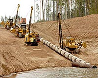
Los Angeles CA (SPX) Feb 10, 2009 Christie, Parker and Hale have announced that the firm prosecuted a major patent application through issuance for its client Guardian ProStar of Grand Junction, Colorado. The patent, U.S. Pat. No. 7,482,973, pertains to GPS technology for managing and avoiding damage to buried utility assets under the ground, retrieval, and display processes that are required to make numerous business decisions including how, when and where excavators should or should not be digging the ground. "We are pleased to have played a significant role in the issuance of this patent for our client," said Raymond R. Tabandeh, the CPH partner who prosecuted the patent. "Unintentional damage to buried utilities is a major problem in the U.S. and, in almost every case, caused by excavation activities during construction. It is typically the result of operators failing to have access to accurate data records of the buried infrastructure locations relevant to the digging operations." Guardian ProStar Chief Executive Officer Page Tucker stated: "There are more than 20 million excavation activities performed annually and each new excavation operation risks conflicting with the more than 30 million miles of utilities installed underground throughout the U.S. In the most catastrophic instances, lives may be lost and an owner, agency or contractor is exposed to serious claims and litigation from major property and environmental damage. More commonly, though, inadvertent damage causes lights to go out, gas to leak into the atmosphere, or traffic flows disrupted. "We believe that accurate display of buried utility location relevant to excavators is perhaps the most critical component to effective damage prevention practices. The patent also falls directly in line with other development projects we are involved in of advanced utility asset management solutions including RFID technology," Tucker concluded. Tabandeh added that the Guardian ProStar patent is particularly timely, noting the Obama administration's stated plans to invest tens of billions of dollars upgrading the nation's current infrastructure. "I believe this patent and the patented system could play a significant role in providing millions of dollars in savings that would otherwise occur as a result of damaging buried utility assets by the planned constructions," Tabandeh said. Related Links Guardian ProStar GPS Applications, Technology and Suppliers
 Redlands CA (SPX) Feb 10, 2009
The beta release of the ArcGIS API for Microsoft Silverlight will coincide with the 2009 ESRI Developer Summit in Palm Springs, California, to be held March 23-26. This new API allows application developers to integrate ArcGIS Server and Microsoft Virtual Earth services and capabilities in a Silverlight application. |
|
| The content herein, unless otherwise known to be public domain, are Copyright Space.TV Corporation. AFP and UPI Wire Stories are copyright Agence France-Presse and United Press International. ESA Portal Reports are copyright European Space Agency. All NASA sourced material is public domain. Additional copyrights may apply in whole or part to other bona fide parties. Advertising does not imply endorsement, agreement or approval of any opinions, statements or information provided by Space.TV Corp on any Web page published or hosted by Space.TV Corp. Privacy Statement |