|
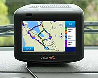
Redlands CA (SPX) Feb 12, 2009 ArcLogistics Navigator, ESRI's in-vehicle navigation solution, keeps fleets on schedule by guiding drivers to optimized stops created in ArcLogistics. Specifically designed for trucking, fleet, and logistics applications, ArcLogistics Navigator creates a complete solution for organizations looking to plan optimum routes and schedules on the desktop and see them followed in the field. ArcLogistics is a complete desktop solution for creating optimized routes and solving scheduling problems. Organizations that use it typically save 15 to 20% in fleet-related costs within months of implementation. The savings are attributed to powerful solvers in ArcLogistics desktop that consider customer time windows, vehicle capacity, driver specialty, and the nature of the street network, helping route planners sequence stops that result in efficient routes. Because ArcLogistics Navigator is tightly integrated with ArcLogistics, route planners can now send these optimized stops directly to in-vehicle devices, ensuring drivers follow the exact streets chosen for the route. The time and mileage spent because of missed turns and looking for stops are minimized because ArcLogistics Navigator gives audible turn-by-turn directions and constantly updates the vehicle's location on the on-screen map, preventing late arrivals and/or lost drivers. "ESRI believes that ArcLogistics Navigator will also improve safety by freeing drivers from having to flip through paper map books, trying to find locations while driving," says Kerry Somerville, Product Manager for ArcLogistics Navigator. Dispatchers can provide drivers with barrier information, such as road closures, construction, or traffic incidents, as well as which roads should be used in route calculations based on the kind of road or vehicle type or size. Because it's a GPS application, should the driver stray from the route, ArcLogistics Navigator will reroute them to the next stop in the optimized route. ArcLogistics Navigator includes NAVTEQ map data for the United States, Canada and Europe. The NAVTEQ dataset for ArcLogistics Navigator includes the latest street geometry with navigational attributes that facilitate turn-by-turn directions and enable in-dash vehicle and portable navigation devices, route planning and map display services. NAVTEQ's extensive street database provides ArcLogistics users a high level of accuracy and helps users find locations and route efficiently to their destinations. ArcLogistics Navigator will help fleets use less fuel, reduce vehicle wear and tear from unnecessary miles driven, and improve customer satisfaction by meeting tight time windows. ArcLogistics Navigator runs on Windows Vista, Windows XP, and Windows Mobile devices (Windows Mobile 5 and 6). Related Links ArcLogistics Navigator GPS Applications, Technology and Suppliers
 Redlands CA (SPX) Feb 10, 2009
The beta release of the ArcGIS API for Microsoft Silverlight will coincide with the 2009 ESRI Developer Summit in Palm Springs, California, to be held March 23-26. This new API allows application developers to integrate ArcGIS Server and Microsoft Virtual Earth services and capabilities in a Silverlight application. |
|
| The content herein, unless otherwise known to be public domain, are Copyright Space.TV Corporation. AFP and UPI Wire Stories are copyright Agence France-Presse and United Press International. ESA Portal Reports are copyright European Space Agency. All NASA sourced material is public domain. Additional copyrights may apply in whole or part to other bona fide parties. Advertising does not imply endorsement, agreement or approval of any opinions, statements or information provided by Space.TV Corp on any Web page published or hosted by Space.TV Corp. Privacy Statement |