|
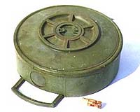
Amsterdam, Holland (SPX) Aug 24, 2007 Researchers in The Netherlands are developing a radar system that might one day see through solid earth and could be used to clear conflict zones of landmines, safely and at low cost. Writing in Inderscience's Journal of Design Research, the team explains how the new technology, with further industrial development, could eventually make vast tracts of land around the globe safe once more. Landmines were first used widely during World War II and continue to represent a significant threat to life and limb in areas afflicted by war. Originally, landmines were used to protect strategic areas such as borders, camps or important bridges and to restrict the movement of enemy forces. The use of landmines has spread to countless national conflicts and they are now commonly used by terrorist and other organizations against civilians and rivals. This has led to a major proliferation of landmines in many areas beyond conventional military conflict zones. In the absence of records, the low cost of landmines and the vast areas that have been polluted with them due to aerial distribution, clearing landmines has become and increasingly frustrating and hazardous task. A single landmine might cost $1, but once in the ground locating it and making it safe can cost up to $1000. According to P. van Genderen and A.G. Yarovoy in the Faculty of Electrical Engineering at Delft University of Technology, this cost is prohibitive in most areas affected by landmine use and so a cheaper solution is needed. The researchers also point out that a detection system that does not distinguish between landmines and other buried objects is not viable. The researchers explain that innovative technologies such as multi-hyper spectral sensors, passive millimeter wave detectors, and charged particle detection could be effective, but are likely to be very costly and complicated to use. Inexpensive methods such as conventional metal detectors and probing of the ground by a human operator are prone to serious error with major repercussions for the operators. They have now turned to ultra-wideband radar as having the potential to be much easier to operate than the sophisticated technology but be just as effective and crucially far less expensive. The team has now developed a prototype system that successfully detects model landmines in a test environment. The detection rate is always offset by the false alarm rate, the researchers explain. The real step forward can be made if this balance can be made more favorable. Further work and development is now needed to shift the balance between detection rate and false alarm rate. Related Links Bringing Order To A World Of Disasters A world of storm and tempest When the Earth Quakes
 Chicago (AFP) Aug 23, 2007
Unrelenting storms and floods have forced thousands of people from their homes, while other states have wilted in a record-breaking heatwave with the death toll from the extreme weather hitting the US rising to almost 50 Thursday. |
|
| The content herein, unless otherwise known to be public domain, are Copyright Space.TV Corporation. AFP and UPI Wire Stories are copyright Agence France-Presse and United Press International. ESA Portal Reports are copyright European Space Agency. All NASA sourced material is public domain. Additional copyrights may apply in whole or part to other bona fide parties. Advertising does not imply endorsement, agreement or approval of any opinions, statements or information provided by Space.TV Corp on any Web page published or hosted by Space.TV Corp. Privacy Statement |