 |
Greenbelt MD (SPX) Apr 27, 2011 A low pressure area currently over northern Illinois and southern Wisconsin has created conditions that call for a forecast of severe weather in the eastern third of the U.S. and one area is even labeled "high risk." The GOES-13 Satellite captured a visible image of the system as daytime heating was boiling up strong and severe thunderstorms. What's unusual about the system is that there are a handful of days where a "high risk" for severe weather is noted by NOAA's National Severe Storms Laboratory (NSSL). April 26, 2011 is one of them. The high risk area includes southern Arkansas, extreme northwest Louisiana and extreme northeastern Texas. A moderate level of risk surrounds that area and stretches from west Tennessee, including Memphis, all of eastern Arkansas, northwest Louisiana and further into northeastern Texas. A slight risk for severe thunderstorms stretches from western Massachusetts through New York, the Appalachian Mountains to the Ohio Valley, Tennessee Valley and through the southeast west toward Texas. See risk map The Geostationary Operational Environmental Satellite called GOES-13 has been getting a workout with all of the severe weather this season. GOES is operated by NOAA and images and animations are created by the NASA GOES Project at NASA's Goddard Space Flight Center in Greenbelt, Md. The image created at 1832 (2:32 p.m. EDT) showed cloud cover associated with the low stretching from New England to east Texas. The cloud cover from Michigan through the Ohio, Mississippi and Tennessee Valleys are associated with the cold front portion of the low pressure area. The clouds associated with the warm front associated with the low stretches east from northern Illinois to Massachusetts. The NSSL noted that flash flooding from the thunderstorms is possible from the area of the front from southwestern Indiana through western Kentucky, western Tennessee, southeastern Missouri, Arkansas and northwestern Mississippi. Severe thunderstorms are possible in those areas today. This storm already has a history of dumping heavy rainfall as the central Mississippi Valley reported up to half a foot of rain from the system and the lower Mississippi Valley experienced as much as a foot in some areas.
Share This Article With Planet Earth
Related Links GOES project page Earth Observation News - Suppiliers, Technology and Application
 Running ring around hurricanes predictions
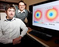
Champaign IL (SPX) Apr 25, 2011 Coastal residents and oil-rig workers may soon have longer warning when a storm headed in their direction is becoming a hurricane, thanks to a University of Illinois study demonstrating how to use existing satellites to monitor tropical storm dynamics and predict sudden surges in strength. "It's a really critical piece of information that's really going to help society in coastal areas, no ... read more |
|
| The content herein, unless otherwise known to be public domain, are Copyright 1995-2010 - SpaceDaily. AFP and UPI Wire Stories are copyright Agence France-Presse and United Press International. ESA Portal Reports are copyright European Space Agency. All NASA sourced material is public domain. Additional copyrights may apply in whole or part to other bona fide parties. Advertising does not imply endorsement,agreement or approval of any opinions, statements or information provided by SpaceDaily on any Web page published or hosted by SpaceDaily. Privacy Statement |