|
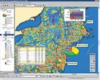
Redlands CA (SPX) Feb 10, 2009 ESRI and Investigative Reporters and Editors have agreed to continue offering IRE members the ability to license ArcView software at a reduced rate. ArcView is ESRI's easy-to-use desktop geographic information system (GIS) software and is the most widely used software by journalists to more effectively communicate local, national, and international stories to readers. "As a professional organization dedicated to improving the quality of investigative reporting, IRE is providing its members with a groundbreaking opportunity to really change the way they report the news," says Simon Thompson, commercial business solutions manager, ESRI. "We are excited to continue our relationship with this outstanding organization and look forward to advancing its mission of fostering excellence in investigative journalism." Many editors and journalists have already taken advantage of this opportunity, finding GIS indispensable for articulating information in ways that weren't possible before. Tom Setzer, graphics editor/computer assisted reporting with The Dallas Morning News, explains, "Since adding ArcView to our set of graphics tools, I've done hundreds of maps and graphics using the software. I consider it as essential to my job; there are maps we create for print and online that, practically speaking, could not be done without it." Doug Caruso, assistant city editor of The Columbus Dispatch, emphasizes, "We turn to ArcView whenever the question 'Where?' pops up. We've shown our readers where political candidates won, where fire departments respond the fastest, and where new laws will allow sex offenders to live." ArcView can be used not only for creating thought provoking maps but also for analyzing data used in stories. "As an environmental journalist, I've used mapping software to analyze toxic pollutants in Ohio River communities, illustrate the damage left by abandoned coal mines, and even show the statewide distribution of Ohio's wild turkeys," says Spencer Hunt, reporter, The Columbus Dispatch. Members of IRE located in the United States will be able to license ArcView and additional extensions for specialized analysis. Licensees are required to attend a qualifying training session within one year of licensing the software. Attending a session ensures that journalists get the most out of the software and allows members to share their knowledge and experience with one another. The many training options that meet this criteria include ESRI's online and nationwide classroom training and computer lab-based training offered by IRE and National Institute for Computer-Assisted Reporting (NICAR). "IRE is pleased to continue our partnership with ESRI," states executive director of IRE, Mark Horvit. "This agreement means that our members will continue to have access to innovative technology that helps them give their audience in-depth information in the best possible format." Related Links ESRI GPS Applications, Technology and Suppliers
 Redlands CA (SPX) Feb 10, 2009
The beta release of the ArcGIS API for Microsoft Silverlight will coincide with the 2009 ESRI Developer Summit in Palm Springs, California, to be held March 23-26. This new API allows application developers to integrate ArcGIS Server and Microsoft Virtual Earth services and capabilities in a Silverlight application. |
|
| The content herein, unless otherwise known to be public domain, are Copyright Space.TV Corporation. AFP and UPI Wire Stories are copyright Agence France-Presse and United Press International. ESA Portal Reports are copyright European Space Agency. All NASA sourced material is public domain. Additional copyrights may apply in whole or part to other bona fide parties. Advertising does not imply endorsement, agreement or approval of any opinions, statements or information provided by Space.TV Corp on any Web page published or hosted by Space.TV Corp. Privacy Statement |