|
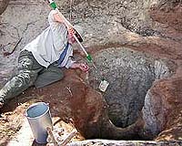
Maynard, MA (SPX) Feb 22, 2007 For the people of Kenya's semiarid Samburu region, water is a precious commodity. People and livestock compete with wildlife for water, and in the dry season water sources can easily become contaminated. To address these issues, scientists at Earthwatch's Samburu Field Center have compiled three years of data on the region's water and other natural resources into a comprehensive Geographic Information Systems (GIS) database. The new GIS database maps water sources, including information about water quality and seasonal variability, as well as habitat quality for wildlife and livestock. These maps provide the latest information on water resources, and will be shared with local communities to inform management plans for settlement, grazing, and conservation lands. This important outcome is consistent with U.N. Millennium Development Goals, especially Goal 7, which includes ensuring sustainable access to improved water sources. "Never again will I take water for granted," said Suzanne Zilvetti of New Jersey, a volunteer at Earthwatch's Samburu Field Center last year. "I felt so much a part of something bigger than just 'seeing wildlife.' It really hit home when, after sitting and counting animals that came to drink from a waterhole (for five hours), we actually saw a touring van taking pictures of us!" "We can share data in a context that communities will understand," said Fred Atieno, a GIS expert and co-investigator at the Samburu Field Center. Layers of information can be added to the GIS maps that show the region's roads, villages, markets, schools, and other features familiar to local communities. Different layers show water source locations and quality, seasonal rivers, and where there is good grazing land or scrubland. "This database will help in the creation of community conservancies," said Atieno, referring to local land-based community groups that can "zone" their land to minimize stress on natural resources. "It will relate conservancies to resources on the ground." Through zoning, conservancies can ensure that people have enough water and livestock have enough grass. They can also help minimize conflicts with elephants and carnivores, and conserve water and habitat for relief during extreme droughts. The map may also help with public health issues, in a population where 80 percent of the diseases diagnosed are waterborne. "If we know a patient comes from a community where the database shows the water is high in amoebas, we know that the patient has a higher chance for that," said Philip Leitore, a coordinator at Wamba Mission Hospital, which has a partnership with the Samburu Field Center. Last year the lab at Wamba Mission Hospital detected cholera in a water sample by Earthwatch-supported scientists, prevented a public epidemic that could have affected many in the Samburu population. The GIS database also shows how wet and dry seasons affect water quality, helping to warn people when and where outbreaks might occur. Related Links Earthwatch's Samburu Field Center Water, Water Everywhere and Not A Drop To Drink... Water News - Science, Technology and Politics
 Washington DC (SPX) Feb 15, 2007
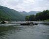
Recent decisions by the U.S. Supreme Court have focused national attention on what bodies of water fall under federal jurisdiction for protection under the Federal Clean Water Act (CWA). The CWA includes many important water quality and pollution prevention programs, particularly for headwaters, bodies of water that often serve as the tributaries for rivers and streams. |
|
| The content herein, unless otherwise known to be public domain, are Copyright Space.TV Corporation. AFP and UPI Wire Stories are copyright Agence France-Presse and United Press International. ESA Portal Reports are copyright European Space Agency. All NASA sourced material is public domain. Additional copyrights may apply in whole or part to other bona fide parties. Advertising does not imply endorsement, agreement or approval of any opinions, statements or information provided by Space.TV Corp on any Web page published or hosted by Space.TV Corp. Privacy Statement |