|
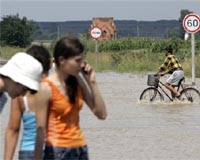
Denver CO (SPX) Feb 17, 2009 Intermap Technologies announced that its flood modeling application used to assess address-specific flood risk throughout the Czech Republic is now commercially available to the general public. The application is available on the Czech Insurance Association's (CAP) web site for all consumers interested in obtaining property information for flood prone areas in the Czech Republic. The flood risk application focuses on the watercourses at risk of causing property damage for 210 of the larger cities and towns in the country. After selecting a specific property, users automatically receive an insurance risk report specifying potential risks related to their selection. Until recently, flood risk information has only been available to insurance companies during the underwriting and risk management process. With the launch of this application, this valuable information is available to any interested party; ranging from insurance customers, lenders, and banks to land developers and home buyers. "The Association decided to make the system open to the public. Before, it was solely used by CAP members when assessing flood risk and calculating rates for customers insuring property. The release of this application means that the public can now use the same tools that the insurance industry uses for flood risk assessment in the Czech Republic. For example, consumers can easily check an individual property location and find out what their insurance options are," explained Tom� S�kora, the chief executive of CAP. Intermap used numerous sources to create the flood risk zones in the application including SwissRe, one of the world's leading reinsurers and a project partner that provided its geomorphological regression model to support the flood zone delineation. "Intermap is very pleased to provide a tool that accurately delineates flood zones, thereby allowing the public to confidently assess flood risks when purchasing property or for other applications," said Dr. Manfred Krischke, vice president, Europe for Intermap Technologies. "This fundamental change in the risk management market is a result of the Company's vision to enable individuals worldwide with the power of knowledge through geospatial applications." Related Links Intermap Technologies GPS Applications, Technology and Suppliers
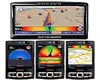 Paris, France (ESA) Feb 17, 2009
A new system is using satellite navigation data to help car drivers develop smart, smooth and safe driving techniques that can help save an average of 15-25% in fuel, as well as contribute to environmental protection. |
|
| The content herein, unless otherwise known to be public domain, are Copyright Space.TV Corporation. AFP and UPI Wire Stories are copyright Agence France-Presse and United Press International. ESA Portal Reports are copyright European Space Agency. All NASA sourced material is public domain. Additional copyrights may apply in whole or part to other bona fide parties. Advertising does not imply endorsement, agreement or approval of any opinions, statements or information provided by Space.TV Corp on any Web page published or hosted by Space.TV Corp. Privacy Statement |