|
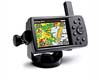
Las Vegas NV (SPX) Jul 17, 2008 Columbus Geographic Systems (GIS) has launched a new product demo for an advanced navigation application for New York's Central Park. Central Park contains several lakes and ponds, extensive walking tracks, ice-skating rinks, a zoo, a wildlife sanctuary, and large areas of natural woods. With about 25 million visitors annually, it is the most visited city park in the United States Columbus' navigation application for Central Park is based on the company's off-road navigation tool, Ranger. The new product demo clearly displays mapping and aerial imagery of the park including over 200 points of interest, and enables visitors to find their own location at any given point. It is very easy to use and works on a range of Personal Navigation Devices (PND). "Central Park is a true island of open space in Manhattan, one of the world's greatest urban areas. Our navigation system is specifically designed for such an open environment and will enable visitors to enjoy the park even more," says Columbus CEO Tsvika Freidman. "We are confident this application can be used in other large city and national parks in the US and other countries around the world."
Columbus Geographic Systems Main products: + Highly-effective off road, outdoor GPS navigation tools, working on a full range of devices including Car PC, PDA, and Personal Navigation Devices (PND), with options for 3D imaging. + Innovative, affordable GIS tools easily used in a range of applications, including businesses, agriculture, surveys, and government agencies. + Aerial GIS applications for military and civilian aircraft operating in complex or threatening environments. Related Links Columbus Geographic Systems (GIS) Demo GPS Applications, Technology and Suppliers
 San Diego CA (SPX) Jul 16, 2008
Researchers at San Diego State University have developed a new concept for improving MEMS accelerometer tunability. This method can increase wide-band tunability with ranges much larger than current practice, a significant improvement from the previously accepted 5-10%. |
|
| The content herein, unless otherwise known to be public domain, are Copyright Space.TV Corporation. AFP and UPI Wire Stories are copyright Agence France-Presse and United Press International. ESA Portal Reports are copyright European Space Agency. All NASA sourced material is public domain. Additional copyrights may apply in whole or part to other bona fide parties. Advertising does not imply endorsement, agreement or approval of any opinions, statements or information provided by Space.TV Corp on any Web page published or hosted by Space.TV Corp. Privacy Statement |