 |
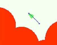
Pasadena CA (JPL) Feb 13, 2007 Until recently, NASA's two Mars rovers, Spirit and Opportunity, could figure only one or two steps ahead in planning a path and driving on their own. New software uploaded to the rovers onboard computers now enables them to look ahead and plan a path to a spot 50 meters (164 feet) away, evading obstacles along the way. With this software, called "Field D-Star" path planner and developed at Carnegie Mellon University, Pittsburgh, the rovers could find their way out of a maze. Opportunity ran the first test of its smarter autonomous driving capability on the rover's 1,014th sol, or Martian day (Nov. 30, 2006). This animation uses color codings to depict that drive. Red areas are "keep-out" zones established by human rover drivers to prevent Opportunity from getting too close to the edge of "Victoria Crater." White represents unknown areas. Green represents areas that would be safe to traverse based on stereo images taken by the rover's navigation cameras. The moving purple diamond represents Opportunity itself. The blue line is the most efficient path to the desired destination. During this particular 10.5-meter (34-foot) drive, Opportunity's new software was still only a backseat driver, watching what happened and making plans but letting the rest of the system handle the driving. The rover still relied on the one-step-ahead system it had been using before getting the new software. Future tests will put the software directly in the driver's seat. So far, tests have been successful. Related Links Mars Rovers at JPL Mars Rovers at Cornell Mars News and Information at MarsDaily.com Mars News and Information at MarsDaily.com Lunar Dreams and more
 Pasadena CA (JPL) Feb 13, 2007
Opportunity has completed a remote sensing campaign at "Cape Desire" and is on the move to the next promontory, called "Cabo Corrientes." Opportunity's odometer rolled past 10 kilometers (6.2 miles) during the 50.51-meter (166 feet) drive on sol 1080. By contrast, the NASA Level 1 requirements for the mission called for achieving at least 600 meters (1,969 feet) with one rover, and the mission design requirement was for 1,000 meters (3,281 feet). |
|
| The content herein, unless otherwise known to be public domain, are Copyright Space.TV Corporation. AFP and UPI Wire Stories are copyright Agence France-Presse and United Press International. ESA Portal Reports are copyright European Space Agency. All NASA sourced material is public domain. Additional copyrights may apply in whole or part to other bona fide parties. Advertising does not imply endorsement, agreement or approval of any opinions, statements or information provided by Space.TV Corp on any Web page published or hosted by Space.TV Corp. Privacy Statement |
