SPACE MART SPACE DAILY SPACE WAR TERRA DAILY MARS DAILY SPACE TRAVEL GPS DAILY ENERGY DAILY
  Space Industry and Business News  
Get Our Free Newsletters Via Email
  
Search All Our Sites at SpaceBank
ISRO To Release Extensive Satellite Imagery By Year End

file illustration only
by Staff Writers
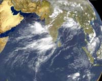
New Delhi (SPX) Jun 06, 2008
Adding a feather to its cap, the Indian Space Research Organisation (ISRO) will launch its own satellite imagery on the internet six months from now, rivalling popular mapping service Google Earth.

"Our images will be on our website six months from now," ISRO To Release Extensive Satellite Imagery By Year End Chairman G Madhavan Nair told reporters here after receiving the Rammohan Puraskar.

Pointing out that certain locations with high security risks were prohibited by law from being imaged, he said, "We are figuring that out. The remaining places, of course, would be on the net."

Earlier, while receiving the award, Nair pointed out that India had the world's largest constellation of remote-sensing satellites.

"With seven satellites in orbit, our remote-sensing satellites provide imagery of the earth in a variety of spectral bands and with a resolution of better than one metre. Data from our remote-sensing satellites are received at about 20 stations across the globe, including the US and Europe," he said.

Nair said the Village Resource Centres (VRC) established in 2004 were providing a variety of space-based products and services, including tele-education, tele-medicine and information on natural resources.

There were 400 VRCs in the country and of these seven are located in West Bengal, he said, adding there were plans to set up 20 more in the state.

Community
Email This Article
Comment On This Article

Share This Article With Planet Earth
del.icio.usdel.icio.us DiggDigg RedditReddit
YahooMyWebYahooMyWeb GoogleGoogle FacebookFacebook


Related Links
Indian Space Research Organisation
Earth Observation News - Suppiliers, Technology and Application


Surrey Wins Satellite Imager Contract For Climate Modelling
Guildford UK (SPX) Jun 03, 2008
Surrey Satellite Technology Ltd (SSTL), the world's leading small satellite manufacturer, has secured a contract worth 1.6 million euros from Astrium GmbH, Germany to proceed with work on a new contract to develop and supply the Multi-Spectral Imager (MSI) for the European Space Agency's (ESA) EarthCARE Mission.


Memory Foam Mattress Review

Newsletters :: SpaceDaily Express :: SpaceWar Express :: TerraDaily Express :: Energy Daily
XML Feeds :: Space News :: Earth News :: War News :: Solar Energy News
  • Analysis: Crackdown on domain name crooks
  • Pacific students lagging in computer age: researcher
  • Icahn moves to replace Yahoo board, restart Microsoft talks
  • Intelsat And Panasonic To Bring Broadband Service To The Skies

  • NASA sets Thursday for GLAST launch
  • Two Ariane 5s Are Readied For Launches In May And June
  • Arianespace Completes The Assembly Of Another Ariane 5
  • Zenit Rocket Powers A Successful Sea Launch Campaign

  • China's new jumbo-jet firm no threat to Airbus, Boeing: state media
  • China unveils new jumbo jet company: report
  • NASA And JAXA To Conduct Joint Research On Sonic Boom Modeling
  • Analysis: Can airplanes go green?

  • Raytheon To Provide Army With New Wideband Receiver Suites
  • Keeping The Military Fully Networked And Online
  • Lockheed Martin Team Delivers Flight Software For Next Missile Warning Satellite
  • Raytheon Tests Distributed Common Ground System Block 10.2 System

  • Paralysed man takes a walk in virtual world
  • Study finds best times for radio signals
  • Self-Repairing Aircraft Could Revolutionize Aviation Safety
  • Northrop Grumman Resonating Gyro Achieves 10 Million Operating Hours In Space

  • Globalstar AppointS Thomas Colby Chief Operating Officer
  • SES AMERICOM Announces Change In Executive Management
  • Bill Flynn Joins Americom Government Services to Lead Navy Programs
  • NASA names science directorate deputy

  • ISRO To Release Extensive Satellite Imagery By Year End
  • EarthCARE Earthcare Satellite Contract Signed
  • GeoEye Gets More Money From US
  • A New Satellite Remote Sensing Tool For Improving Agricultural Land Use Observation

  • Lockheed Martin Launches GMLRS Rocket From HIMARS With GPS-Aided Fire Control
  • Kyocera Wireless Announces Brew Support And Developer Tools For New M2M Modules
  • Trimble Introduces GNSS Reference Sensor For Infrastructure And Network Applications
  • Universal Receiver Tester Offers Innovative GPS Test And Simulation Capabilities

  • The content herein, unless otherwise known to be public domain, are Copyright 1995-2007 - SpaceDaily.AFP and UPI Wire Stories are copyright Agence France-Presse and United Press International. ESA Portal Reports are copyright European Space Agency. All NASA sourced material is public domain. Additional copyrights may apply in whole or part to other bona fide parties. Advertising does not imply endorsement,agreement or approval of any opinions, statements or information provided by SpaceDaily on any Web page published or hosted by SpaceDaily. Privacy Statement